


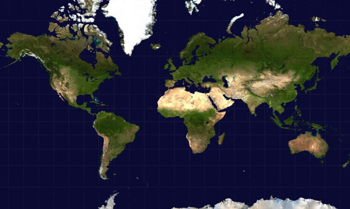


In a cartographic push designed to reflect the Global South more accurately, the UN General Assembly backed a world map that displays the relative sizes of continents and nations more faithfully. Adopted on September 4 with India’s backing, the resolution calls for the adoption of the Equal Earth Projection map to replace popular models like the Mercator Projection, which heavily exaggerates the size of northern countries. The vote passed with 164 votes in favor, while six countries abstained and the United States stood as the sole objector.
Origins and Critique of the Mercator Projection:
Named after 16th-century Flemish mapmaker Gerardus Mercator, the Mercator Projection remains the most common basis for global maps. Mercator originally developed the map for marine navigation during the onset of European colonial conquests, resulting in distortions that became tied to the geopolitical worldview of that period. Togo’s Foreign Minister Robert Dussey, whose country led the campaign, stated that correcting the map is vital to ensuring every region is represented with accuracy and dignity. The severe distortions of the Mercator map are vividly demonstrated in how it depicts Greenland as having the exact same area as Africa despite Africa possessing 14 times more physical area and portrays Europe as larger than South America, even though South America is roughly 75 percent bigger by area.
Impacts on Specific Nations and Regional Representation:
Under the Equal Earth Projection, the representation of India does not change significantly, with the primary discernible difference being that India’s peninsular section is slightly less angular and widens out marginally. Meanwhile, the United States is depicted smaller on the Equal Earth map, more faithfully reflecting its true physical area relative to other nations. Conversely, Russia which appears considerably larger on standard Mercator maps voted in support of the resolution, categorizing it as an anti-colonial move.
Debate, Advisory Status, and Legal Scope:
The resolution drew sharp criticism from Washington, with Deputy U.S. Representative Yaryna Ferencevych denouncing the measure as part of a “much larger and more radical ideological project” that harms the UN’s credibility. In contrast, the European Union supported the measure while emphasizing that it remains strictly limited to cartographic representation for educational, awareness-raising, and geographical literacy purposes. Because the General Assembly resolution is strictly advisory, it does not mandate any nation or institution to replace Mercator-type maps with Equal Earth alternatives.